This satellite photo from Google Earth shows numerous schools and churches within walking distance of the proposed porn shop at 135 King Street. These include:
Clarke School for the Deaf
Helen Hills Chapel
Saint John’s Episcopal Church
Smith College
Academy of Music
Bridge Street School (elementary grades)
Sacred Heart School
First Church United Church of Christ
College Church
Valley Christian School
New Directions School
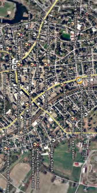
Please note this map is somewhat old and some institutions, such as the Burnam School, Hawley School, Northampton Junior High School, Commercial College, Saint Michael’s School, and the William Street School are no longer in the area. On the other hand, institutions not on the map but currently in the neighborhood include the Northampton School of Dance, St. Valentine’s National Catholic
Church, Vineyard Church, The Montessori School of Northampton
(elementary grades) and Smith College Campus School (elementary grades).
You’re the garetest! JMHO